|
[The Sussex Diamond Way]
[The Wey-South Path] [The Essex Way] [Links] [Stour & Orwell] [Thanet Coast Path] [Grand Union] [Wealdway] [HWLT] [SDW] [Elham] [Regents Canal] [1066] [SSW] [PW NCP] [Cotswold] [SVW] [DVP] [SBP] [Thames] [SWCP] [Gipping Valley River Path] [Speyside] [Three Castles Path] [GGW] [Eden] [NDW] [Capital Ring / Parkland Walk] [MVW] [The Loop] [Ridgeway] [TWC] [RMCP] [SMW] [Fife Coastal Path] [OVW] [Vanguard] [Lea Valley Walk] [Resources] [Greensand Way] [The Monarch's Way] [E2] [Sandlings Walk] [Solent Way] [Weavers Way] [Fynn Valley Way] [Scafell Pike] [Snowdon] [Ben Nevis] [Pentland Hills] [Hangers Way] [Staunton Way] [Downs Link] [Airdrie Bathgate Cycle Path] [Thames Down] [Marriot's Way] [Bournemouth Coast Path] [Forest Way] [Icknield Way] [Suffolk Coast Path] [Angles Way] [River Parrett Trail] [New River Path] [Stour Valley Path] [St Edmund Way] [Centenary Walk] [John Muir Way] [Paston Way] [East Mendip Way] [Orford Ness] [Lindisfarne] [Southern Upland Way] [Berwickshire Coastal] [Beverley Brook Walk] [Chess Valley Walk] [West Mendip Way] [Strawberry Line] [Colne Valley Trail] [Hillingdon Trail] [Huddersfield Canal Towpath Walk] [Trans Pennine Trail] [Pennine Way] [North Berwick Law] [Green Chain Walk] [Ridgeway London] [Waterlink Way] [Greenwich Meridian Trail] [Shuttle Riverway] [Kelvin Walkway] [Clyde Walkway] [Union Canal Walk] [New Lipchis Way] [Brent River Park Walk] [Dog Rose Ramble] [Pymme's Brook Trail] [Dollis Valley Greenwalk]
|
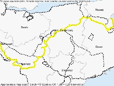
Stour Valley Walk
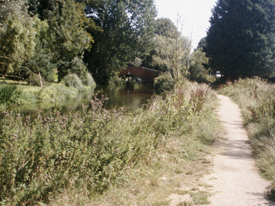
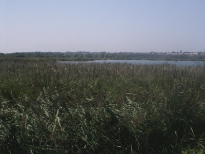
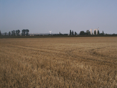
A 51.5 Mile / 82.4 Km route from the source of the river stour at Lenham Kent, to the sea at Pegwell Bay. Walked as: Lenham to Ashford, Ashford to Canterbury, Canterbury to Sandwich, Sandwich to Pegwell Bay. I would not say this is the most scenic of the many Kent routes, but is certainly pleasant beyond Ashford. I only have pictures from Canterbury on due to the aforementioned piccy massacre. Lenham to Ashford2004 - 13 MilesNo Photos Ashford to Canterbury2004 - 18 MilesNo Photos Canterbury to SandwichSaturday 14 August 2004ID14082004
Somewhere past Fordwich
Across the Stour from Upstreet
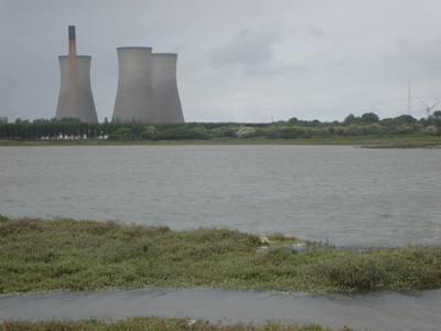
Richborough power station in distance Sandwich to Pegwell Bay (Shell Ness)Monday 29 May 2006 - 3.5 MilesThis little lump walked a long time after rest of route. I retraced my steps to the outskirts of Sandwich then pressed on with Saxon Shore Way
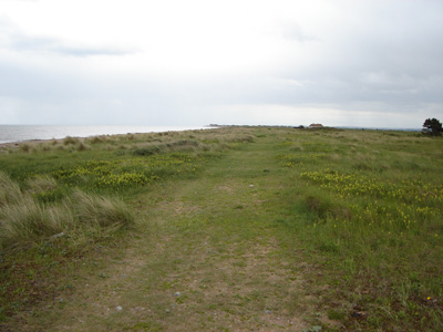
On the beach near Shell Ness
Shell Ness - time to turn round, or start swimming! |