|
[The Sussex Diamond Way]
[The Wey-South Path] [The Essex Way] [Links] [Stour & Orwell] [Thanet Coast Path] [Grand Union] [Wealdway] [HWLT] [SDW] [Elham] [Regents Canal] [1066] [SSW] [PW NCP] [Cotswold] [SVW] [DVP] [SBP] [Thames] [SWCP] [Gipping Valley River Path] [Speyside] [Three Castles Path] [GGW] [Eden] [NDW] [Capital Ring / Parkland Walk] [MVW] [The Loop] [Ridgeway] [TWC] [RMCP] [SMW] [Fife Coastal Path] [OVW] [Vanguard] [Lea Valley Walk] [Resources] [Greensand Way] [The Monarch's Way] [E2] [Sandlings Walk] [Solent Way] [Weavers Way] [Fynn Valley Way] [Scafell Pike] [Snowdon] [Ben Nevis] [Pentland Hills]
|
The Wey-South Path
A walking path of 36 miles, linking the North Downs Way near Guildford, Surrey with South Downs Way near Amberley, W Sussex. Intended as closely as possibel to follow the Wey & Arun Junc Canal and Arun navigation. The Wey and Arun Canal Trust have been endeavouring since 1970 to recommision as much of this defunct canal navigation as possible - at present roughly 3 miles has been restored, so I am a canal and railway Annierak! Website of the Wey-Arun Canal Trust Guildford to NewbridgeSunday 12 October 2008 - 23 MilesID12102008#43 Finally got shufflin on this one - I am trying to get all the walks that I have guidebooks for already on the go. A lovely autumn day, with beautiful colours, and quite warm and dry. However, I developed a migraine as the walk progressed (normally know before setting off) and so had an interesting routine of a few miles walk, sit down, be sick, and start again - and I also get an overwhelming feeling of chronic sleepiness as well, so quite a battle to finish this one - finally made it to Billingshurst in the dark, dodging cars with my dodgy torch! A real shame, as this is a fantastic walk. You don't get to do much of the towpath, but the countryside is exquisite - my first walk since Cornwall - a reminder that the south east does have a lot to offer...this walk continues from where I left of on the E2 (Wey Navigation)
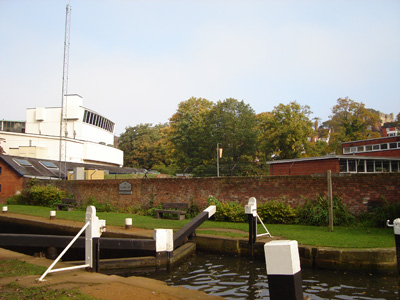
The start of the walk at Millmead Lock, Guildford
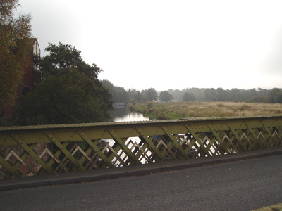
Broadford Bridge. Shortly beyond this point, the Wey & Arun Canal leaves the River Wey & Godalming Navigation
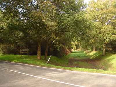
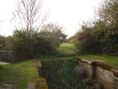
Stonebridge. This is where things get interesting. The former canal ran to the left of picture (a sign in the distance is of the Wey & Arun Canal Trust) and you follow the downs link former railway for a few miles to Run Common
The south side of Stonebridge. The infilled canal ran through the arch. Been here previously - cycling the Downs Link
Looking north at Run Common - the road cuts straight through
Back to the canal (Briefly) after another long detour from Run Common. I speculate that the reasons for these unwarranted diversions is mostly to do with 'Git Orf Moi Land' merchants - in this case (Surrey) more to do with not wanting their views from the county pile spoilt by the 'hoi polloi' - or a better explanantion?
Near Fast Bridge there are some watered (although not navigable) sections - obviously stagnant water
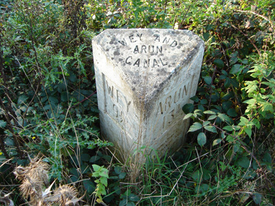
One of the modern distance markers
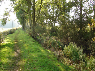
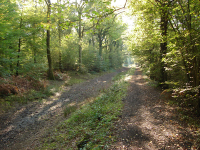
Sidney Wood - attractive dry section
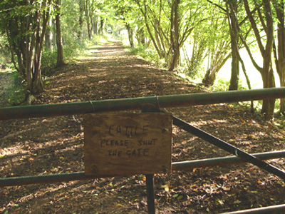
Blimey - clever cattle! (Carbon dated joke)
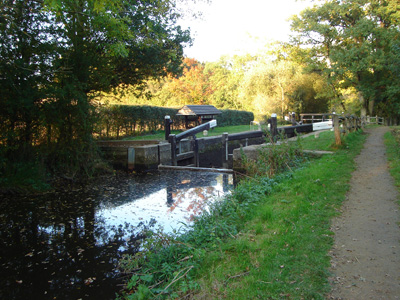
Devil's Hole Lock - I unwillingly helped raise the water level marginally - courtesy of my migraine...
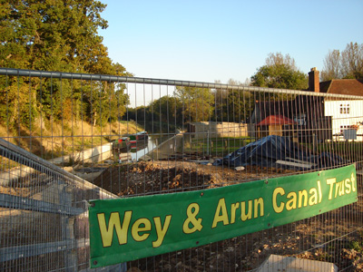
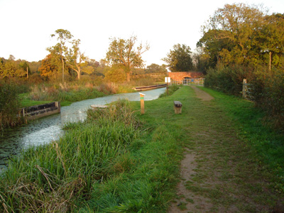
Loxwood is where you really see the hard work being put into restoring parts of this canal - the point beyond here (southwards) is navigable for over 2 miles
Baldwin's Knob Lock
Drungewick Aqueduct - another diversion from the towpath. From here to Newbridge no more pictures - It's getting dark early again... Newbridge to AmberleySunday 19 October 2008 - 13 MilesID19102008#44 Well, a much nicer occasion than last weeks chuck fest... a bit muddy in places, but overall, apart from the maddening unnecessary deviations from the towpath, it was very pleasant - only just made it before dark this time
Newbridge, outside Billingshurst
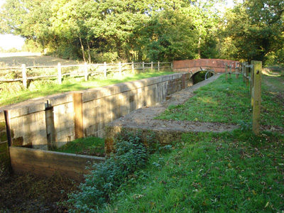
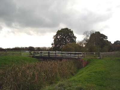
Lordings Lock and Aqueduct - being renovated. Bizarre isolated structure
Then...a field!
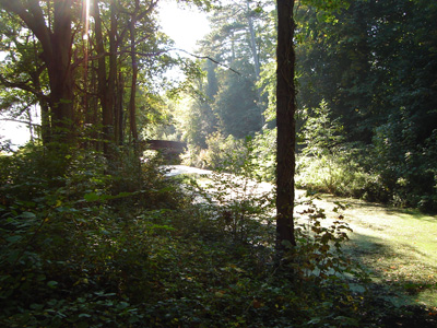
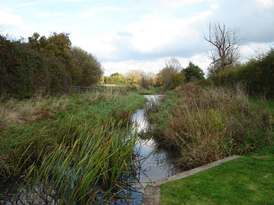
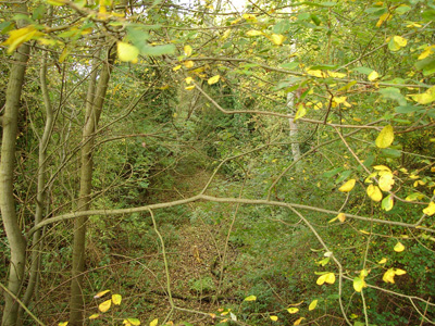
Followed by a beautiful watered, non navigable section, in remote countryside
Haybarn swing bridge - it's deviation time again...
Okay!
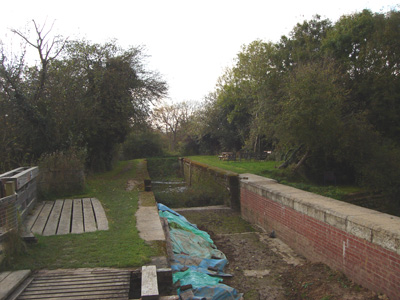
More dry canal bed
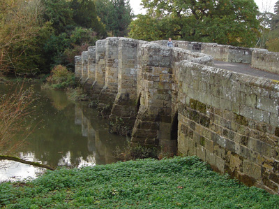
Old Stopham Bridge - 1403! Fortunately this no longer carries highway traffic
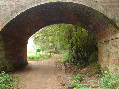
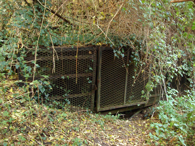
South portal of Hardham Tunnel - the only one on the canal. 375 Yards long, but a bit fluxed now!
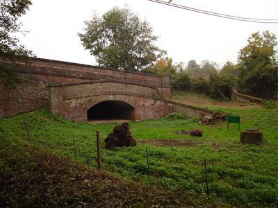
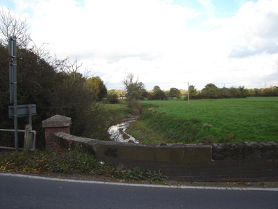
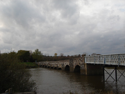
Greatham Bridge - River Arun. Built 14th Century, extended 19th
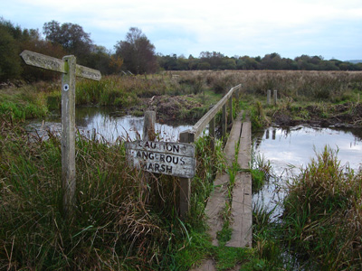
Rather forbidding final section - 'Caution Dangerous Marsh' - was a bit squishy underfoot
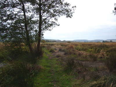
Finally the South Downs beckon |

|
[Home][The Sussex Diamond Way][The Wey-South Path][The Essex Way][Links][Stour & Orwell][Thanet Coast Path][Grand Union][Wealdway][HWLT][SDW][Elham][Regents Canal][1066][SSW][PW NCP][Cotswold][SVW][DVP][SBP][Thames][SWCP][Gipping Valley River Path][Speyside][Three Castles Path][GGW][Eden][NDW][Capital Ring / Parkland Walk][MVW][The Loop][Ridgeway][TWC][RMCP][SMW][Fife Coastal Path][OVW][Vanguard][Lea Valley Walk][Resources][Greensand Way][The Monarch's Way][E2][Sandlings Walk][Solent Way][Weavers Way][Fynn Valley Way][Scafell Pike][Snowdon][Ben Nevis][Pentland Hills]
|
