 |
|
|
|
|
|
[The Sussex Diamond Way]
[The Wey-South Path] [The Essex Way] [Links] [Stour & Orwell] [Thanet Coast Path] [Grand Union] [Wealdway] [HWLT] [SDW] [Elham] [Regents Canal] [1066] [SSW] [PW NCP] [Cotswold] [SVW] [DVP] [SBP] [Thames] [SWCP] [Gipping Valley River Path] [Speyside] [Three Castles Path] [GGW] [Eden] [NDW] [Parkland] [MVW] [The Loop] [Ridgeway] [TWC] [RMCP] [SMW] [Fife Coastal Path] [OVW] [Vanguard] [Lea Valley Walk] [Resources] [Greensand Way] [The Monarch's Way] [E2] [Sandlings Walk] [Solent Way] [Weavers Way] [Fynn Valley Way]
|
Monarch's Way
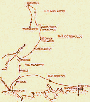
A very long distance path, at 615 miles, following as closely as understood, the travels of King Charles II after the battle of Worcester in 1651, before escaping to France from Shoreham, W.Sussex The route runs south through the midlands, cotswolds, mendips and then east along the downs, so much spectacular scenery and lovely places are along the way. On the Charmouth - Shoreham section, visited are: Yeovil, Wincanton, Hambledon, Arundel and Brighton to name a few. I will be concentrating my initial efforts on the way contained in book three covering the walk, ie from Charmouth to Shoreham, which is still a biggie, at 225 miles. It just sounds like a very exciting long challenge (to me!) but it will be done piecemeal over many years as I get further West it is difficult and expensive to do regularly. Upper Beeding To ShorehamSunday 9 March 2008 - 16.5 MilesWalk ID09032008#9 Finally, started! Been looking forward to this section for a long time. The walk describes a meander Eastwards across the Downs near Portslade, bounces along the edge of the A27, then heads to Hove, and Brighton Pier, then back , this time along the seafront, to Shoreham Harbour. An eclectic mix of open, quiet countryside, and the hustle and bustle of the city and shopping. I expect the rest of the Monarch's Way to be a real treat.
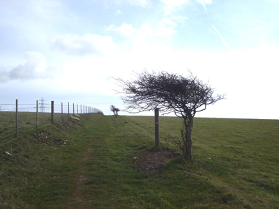
Very windswept section, climbing up from Upper Beeding onto the Downs
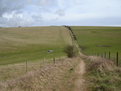
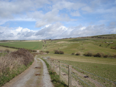
The path stretches out for miles...
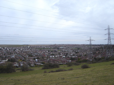
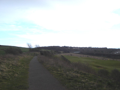
Looking down to Portslade and Mile Oak
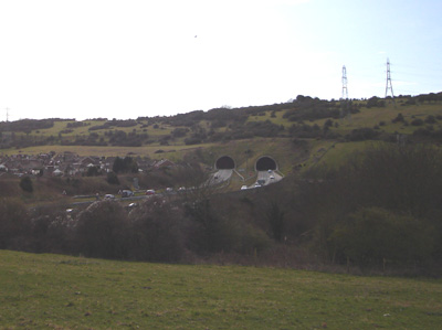
Southwick Tunnel - A27
Passing West Hove Golf Club
This part is on the trackbed of the former railway to Devil's Dyke, as you head towards 'civilisation' at Aldrington
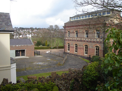
The former British Engineerium at Hove. Hopefully this will reopen soon - I remember visiting here in 1982 or 83!
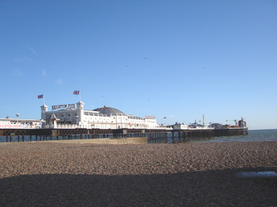
Brighton Pier, and now following the coast to Shoreham
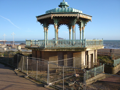
Decrepid Bandstand and West Pier skeleton in background
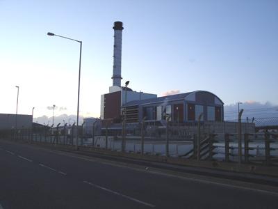
Shoreham power station
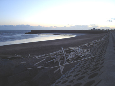
Shoreham Harbour Breakwaters - end of journey. The wood was washed up from a recent shipwreck - The 'Ice Prince' which sank about 26 miles (42km) off Dorset and littered a huge quantity of wood all along the south coast Arundel to Upper Beeding03 May 2008 - 17 MilesWalk ID03052008#15 At last - finally got back to some good old fashioned long distance walking action! Had some time off doing a few mundane walkies, such as Headcorn - Tenterden and also interrupted by 'can't be bothered itiss' and a great weekend on the Isle Of Wight (I so wanted to do some of the coast path, but was not able to take time away from clients) Anyway, this second installment was very pleasant - a beautiful bright day, and stunning scenery meant I was in Upper Beeding before you can say Berghaus! A bit strange at the A280 crossing before Findon, I got slightly lost, retraced my steps, then came across a gentleman who was in the same position. I consulted my guide book and enlightened us both as to the correct route - he never said thank you though, and motored off into the distance,ungrateful man!
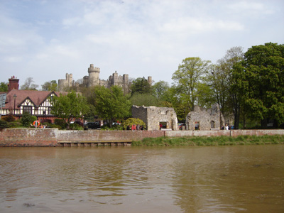
Arundel Castle from the river Arun (apparently, when I wiki'd it's ass - the river is named after the town, not the other way round). Even though the town has a Cathedral (Roman Catholic), it is not a city - why?
Beautiful display of Bluebells in Angmering Park (British or Spanish?)
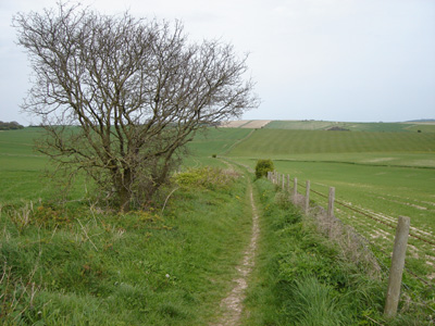
Hitting the downs past Findon - very moreish!
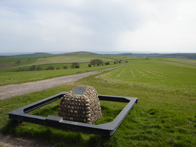
Where the Monarch's joins the South Downs Way, a couple of miles out of Steyning. It is always a bit weird for me meeting a trail that I had walked in the past - I cannot specifically remember the date , but it would have been 2003.
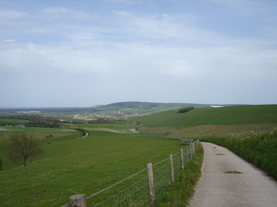
Coming down towards Steyning, Bramber and Upper Beeding
|

|
[Home][The Sussex Diamond Way][The Wey-South Path][The Essex Way][Links][Stour & Orwell][Thanet Coast Path][Grand Union][Wealdway][HWLT][SDW][Elham][Regents Canal][1066][SSW][PW NCP][Cotswold][SVW][DVP][SBP][Thames][SWCP][Gipping Valley River Path][Speyside][Three Castles Path][GGW][Eden][NDW][Parkland][MVW][The Loop][Ridgeway][TWC][RMCP][SMW][Fife Coastal Path][OVW][Vanguard][Lea Valley Walk][Resources][Greensand Way][The Monarch's Way][E2][Sandlings Walk][Solent Way][Weavers Way][Fynn Valley Way]
|
