[The Wey-South Path]
[The Essex Way]
[Links]
[Stour & Orwell]
[Thanet Coast Path]
[Grand Union]
[Wealdway]
[HWLT]
[SDW]
[Elham]
[Regents Canal]
[1066]
[SSW]
[PW NCP]
[Cotswold]
[SVW]
[DVP]
[SBP]
[Thames]
[SWCP]
[Gipping Valley River Path]
[Speyside]
[Three Castles Path]
[GGW]
[Eden]
[NDW]
[Capital Ring / Parkland Walk]
[MVW]
[The Loop]
[Ridgeway]
[TWC]
[RMCP]
[SMW]
[Fife Coastal Path]
[OVW]
[Vanguard]
[Lea Valley Walk]
[Resources]
[Greensand Way]
[The Monarch's Way]
[E2]
[Sandlings Walk]
[Solent Way]
[Weavers Way]
[Fynn Valley Way]
[Scafell Pike]
[Snowdon]
[Ben Nevis]
[Pentland Hills]
[Hangers Way]
[Staunton Way]
[Downs Link]
[Airdrie Bathgate Cycle Path]
[Thames Down]
[Marriot's Way]
[Bournemouth Coast Path]
[Forest Way]
[Icknield Way]
[Suffolk Coast Path]
[Angles Way]
[River Parrett Trail]
[New River Path]
[Stour Valley Path]
[St Edmund Way]
[Centenary Walk]
[John Muir Way]
[Paston Way]
[East Mendip Way]
[Orford Ness]
[Lindisfarne]
[Southern Upland Way]
[Berwickshire Coastal]
[Beverley Brook Walk]
[Chess Valley Walk]
[West Mendip Way]
[Strawberry Line]
[Colne Valley Trail]
[Hillingdon Trail]
[Huddersfield Canal Towpath Walk]
[Trans Pennine Trail]
[Pennine Way]
[North Berwick Law]
[Green Chain Walk]
[Ridgeway London]
[Waterlink Way]
[Greenwich Meridian Trail]
[Shuttle Riverway]
[Kelvin Walkway]
[Clyde Walkway]
[Union Canal Walk]
[New Lipchis Way]
[Brent River Park Walk]
[Dog Rose Ramble]
[Pymme's Brook Trail]
[Dollis Valley Greenwalk]
[Wandle Trail]
[Celandine Route]
[Paths to Prosperity]
[Snaefell]
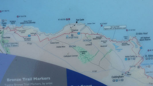
Berwickshire Coastal Path
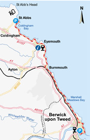
The path has recently been extended, and now connects with the Southern Upland Way at Pease Bay, and runs along the rugged coast across St Abbs Head, St Abbs (optional Coldingham connection) then along to Eyemouth, and through Burnmouth, crossing the English Border and eventually arriving at Berwick Upon Tweed. The path is around 28 Miles long now. This is also apparently part of the North Sea Trail, but the websites are rather shite and don't show the extant sections with any clarity (bit like mine then really)
Coldingham to Eyemouth via St Abbs Head
Wednesday 25 August 2010 - 8.39 Miles
ID25082010#23
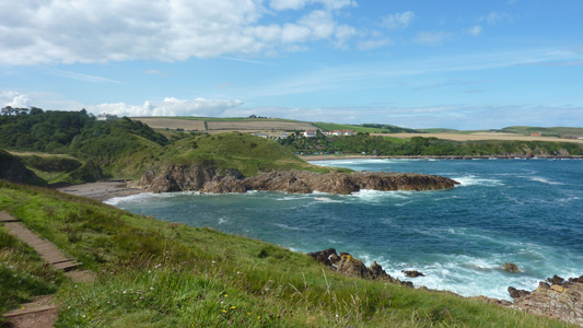
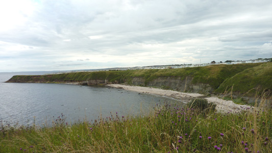
After chassis dump at Coldingham by Dad n Mags, I walked on to St Abbs, where I met up again and walked with my Dad up to the Lighthouse on St Abbs Head, a bit of a climb in places, but quite spectacular. Not actually on the walk route but not to be missed. After walking back into St Abbs, I then left them drive on to Eyemouth, whereas I kept walking, with a couple of climbs at Coldingham Bay, with a beautiful (and busy) sandy beach. After a couple of miles another climb from the beach at Limkin Shore, and the rest was lovely level cliff walking, arriving in Eyemouth via the large caravan site, finishing at the seawall (near the Coop!) and got soaked by a big wave that came over the top. Got a damm fine Ice Cream from an Italian Cafe in town. Nice drive back to Pease Bay
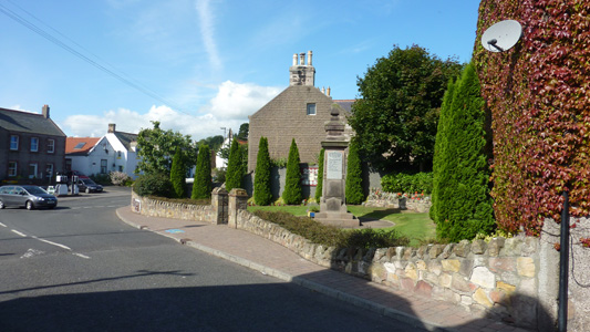
Coldingham
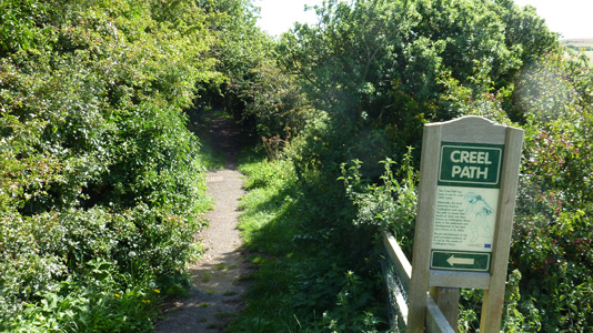
Charming Creel Path to St Abbs. St. Abbs was originally called Coldingham Shore. Prior to any buildings the fishermen who worked their boats from the beach resided at Fisher's Brae in Coldingham. These fishermen had to carry their fishing gear the one and a half miles down a path. The path is now known as the Creel Path, Creel is the local name for a Lobster pot.
Near St Abbs, you can turn right to Coldingham Sands
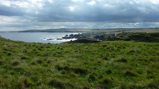
Pretty St Abbs - passing through for the first time

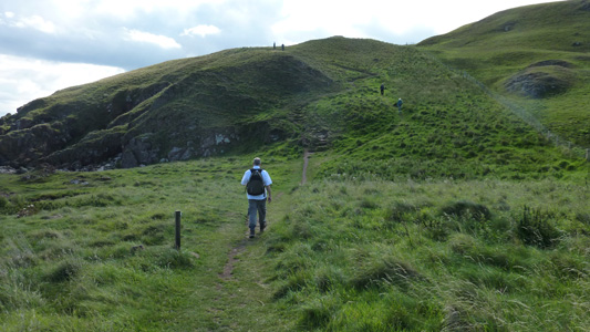
After hooking up with Dad, headed slightly north on a loop round St Abbs Head (as you do)
I did not realise how large and varied St Abbs Head is - not one climb, but several, but quite spectacular
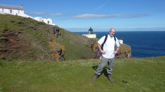
I had the honour of walking with my Dad, who seems to like all this up and down stuff - I am more a fan of gently undulating walks, but in retrospect (after recovering) they are always worthwhile
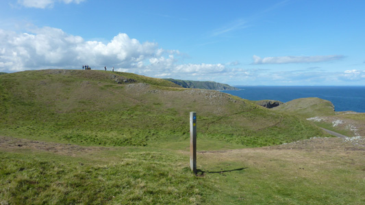
Looking north - the summit is where the peeps are. From here in the far distance I could see to Torness Power Station
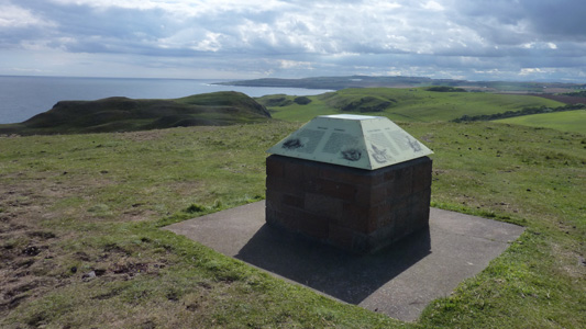
Looking South from Summit Info
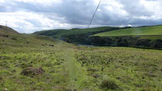
On return, passing by Mire Loch
Drat! Another hill
Soon to pass back through St Abbs
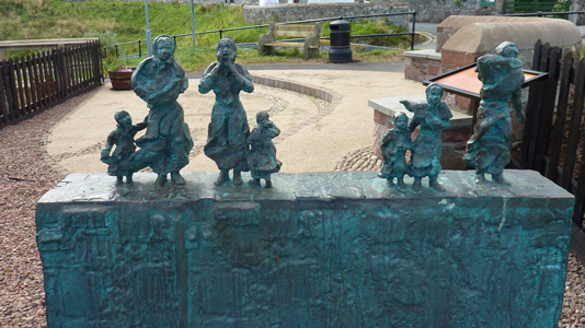
Moving tribute to loss of life at sea
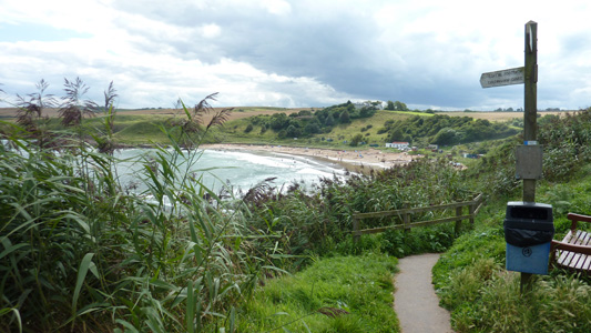
After lunch, headed on alone (ahh!) Approaching Coldingham Sands
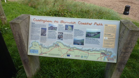
BCP Info Board
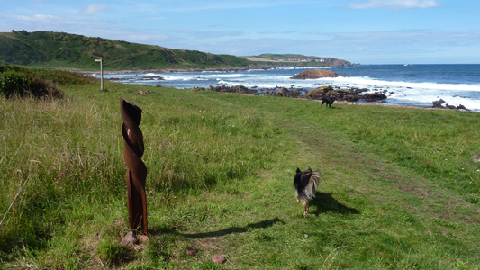
Linkim Shore - Giant Drill Bit and doggie
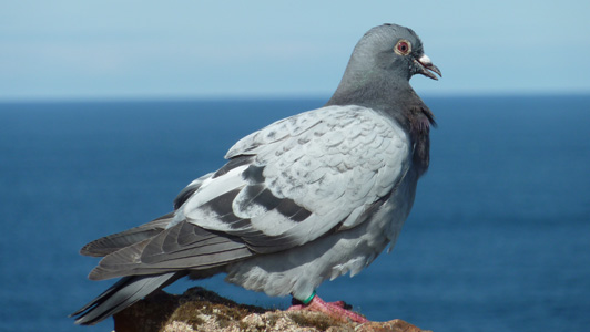
Callercove Point - This sweet little pigeon just sat there while I walked within a metre of it. I have only just noticed that it has a marker, so maybe its someone's homing pigeon having a breather!
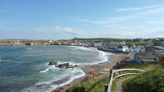
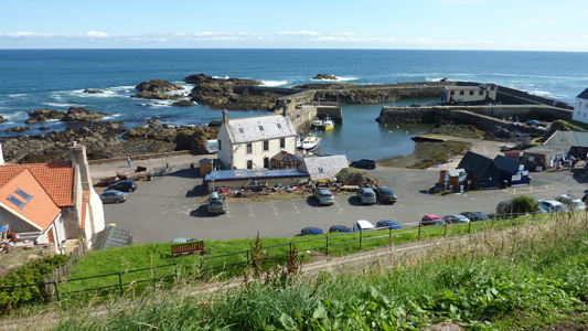
Eyemouth. A pleasant enough little town. Met back up with the folks - had a kick ass icecream, then a nice ride back along the coast to Pease Bay
Eyemouth to Berwick Upon Tweed
Thursday 18 August 2011 - 12 Miles
ID18082011#7
Back in Scotland - but with another couple of days stationed at Pease Bay. My Dad came along on this adventure and it was lovely to have company on this beautiful walk along the Northumbrian coast, also the first time I have ever crossed into another country while walking!
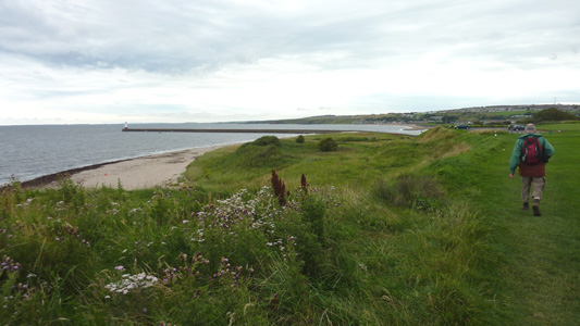
From Eyemouth harbour straight back to the coast, followed along many heads to Burnmouth, where the path dipped down away from the coast slightly, then back, following near the East Coast Main Line for most of the way. The path was reletively level from Marshall Meadows, a short distance on from the English Border. The path faithfully sticks to the coast passing in front of Berwick, and it is only when you reach the harbour (River Tweed) that you head into the town. We finished the walk right in the main street by the big clock where our weary carcasses were picked up by car
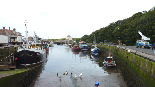
Eyemouth Harbour
The choppy path to Burnmouth - Dad coping well
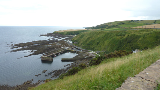
The Harbour below Burnmouth
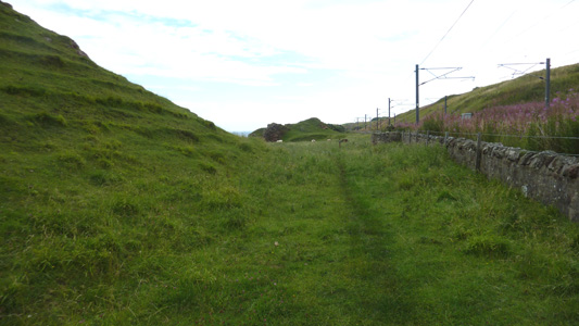
Following for miles by the ECML, trains speeding past between England and Scotland
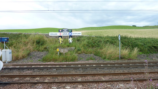
The Border on the ECML
Caravan park just over the border
A lovely section near Berwick, with a 'door' cut into the rock by the sea
Another caravan park perched up on the Berwick cliffs
Approaching the Harbour at Berwick
Almost job done at Berwick Harbour. Just walked into town and had a ruby before heading back to Pease Bay
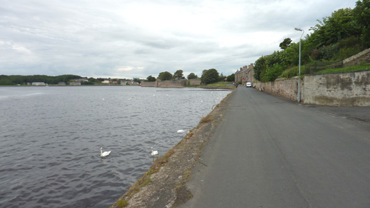
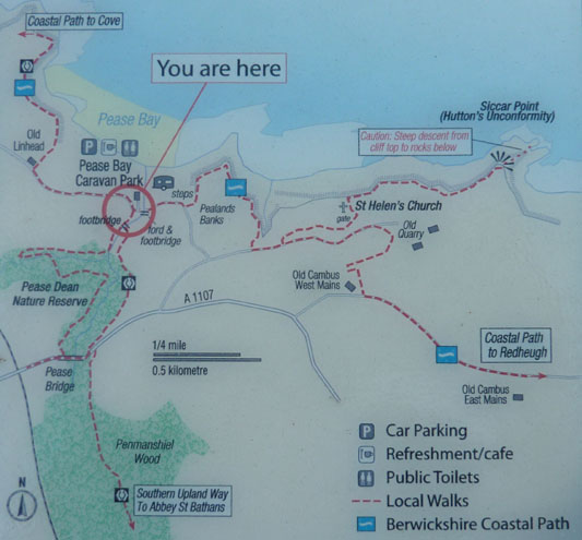
Pease Bay to St Abbs
Friday 24 August 2012 - 10 Miles
ID24082012#48
I guess this bit is really a part of the North Sea Trail and I may relist it under that separate heading, but for now I list it here as it is a recently completed connecting path between the point at Pease Bay where the Southern Upland Way turns inland, and the rest of the Berwick Coast Path from (Coldingham) St Abbs onwards to Berwick-Upon-Tweed, but even though a lot of effort has clearly gone into this path, not much has been made of online resources.
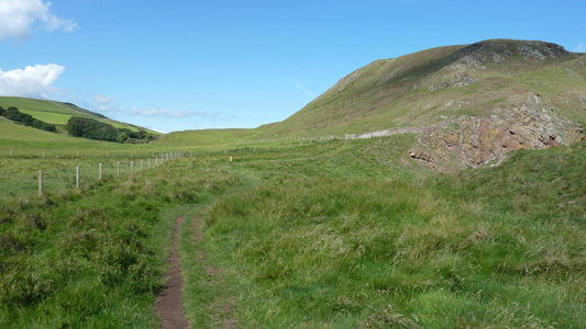
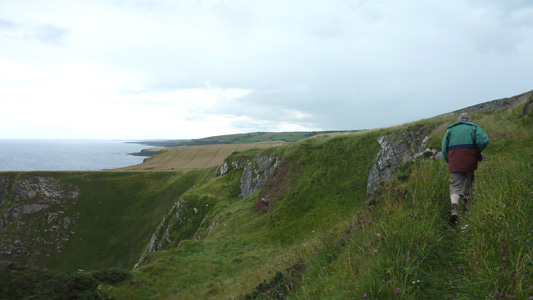
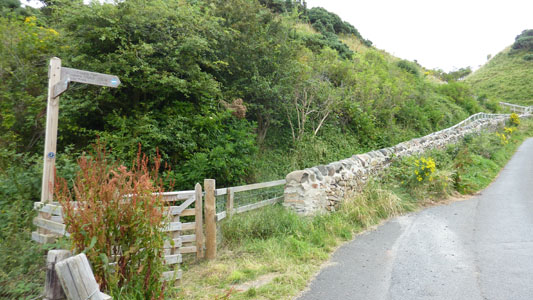
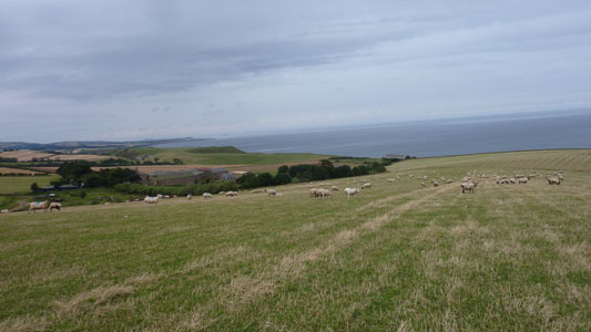
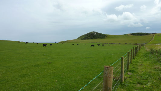
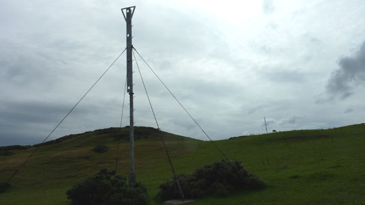
After strolling along from the caravan, the path commences at Pease Bay (Also the James Hutton Way initially) with a fingerpost and then heads up steps to then follow the cliff line before bearing away slightly to a small road, where a path can be followed to Siccar Point, with info on James Hutton, but I kept on the BCP, climbing slightly round the back of an old Quarry (now busy with HGVs) to reach the road leading East to soon reach Redheugh Farm. From here a strenuous uphill section passing through a few fields of rather alarmed sheep, then following a rough track East, to wade through tall grass following the rough terrain near the sea, heading up to a transmitter tower, and following parallel with a road initially, where I disturbed a bird of prey busy chowing down on a fresh kill, then walking on the road for a mile and a a half to Dowlaw, with stunning views inland and over the coast. Reaching a little farm, the way then again on rough tracks, reaching the first Admiralty Distance Pole (Measured Mile), and then on rather undulating and beautiful coast to face a bit of a drop and a knackering climb soon with views over Coldingham Lock, before reaching the second distance pole. Some more undulating cliffs then a view with St Abbs Head straight ahead, where you drop down to the road that leads to the Lighthouse and village. As I had already walked St Abbs Head previously I took the easier option and turned right along the road into the village where I hooked up with my Dad and Mags for some lunch before going onto Berwick-Upon-Tweed for the rest of the day
A photo of the route, this on my cameras LCD screen was occasionally the only way I could check I was on track
Another more localised route interp board
The segregated path leading up to the cliff top at Pease Bay
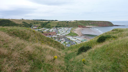
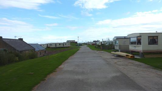
A view over Pease Bay Caravan Park
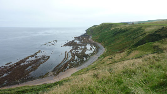
The way ahead
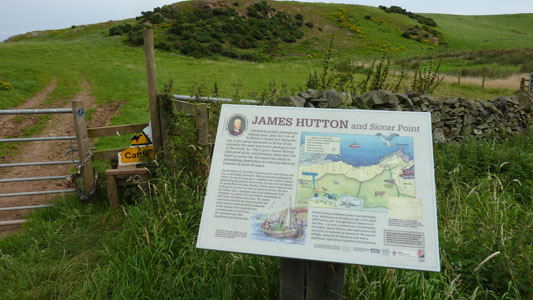
James Hutton interp board and junction with path to Siccar Point
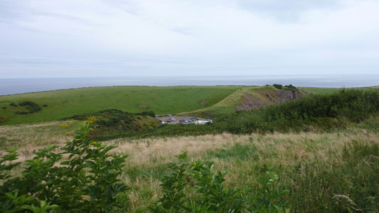
Siccar point from above the old quarry
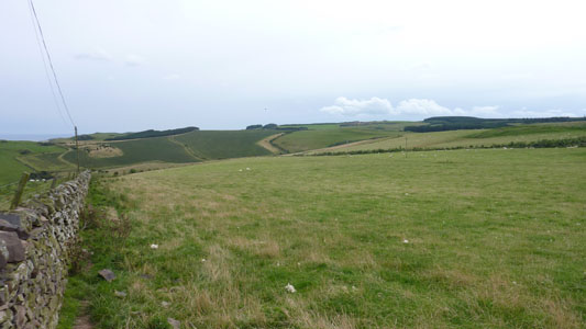
Redheugh Farm
A view back over Redheugh, with Torness Power station just a little speck in the distance
![]()
Ascending to the road and transmitter mast
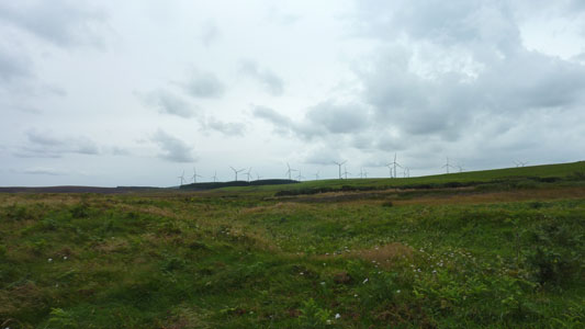
Windfarm from the road leading to Dowlaw
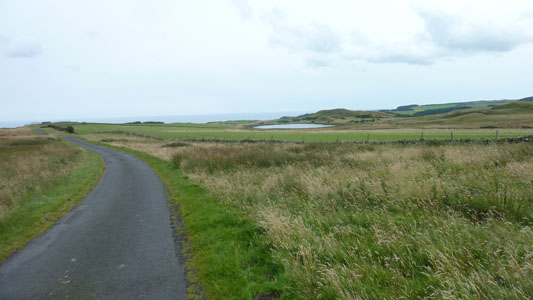
The road leading to Dowlaw
Beyond Dowlaw
Green and pleasant
Admiralty Distance Pole - Measured Mile device used in the olden days
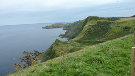
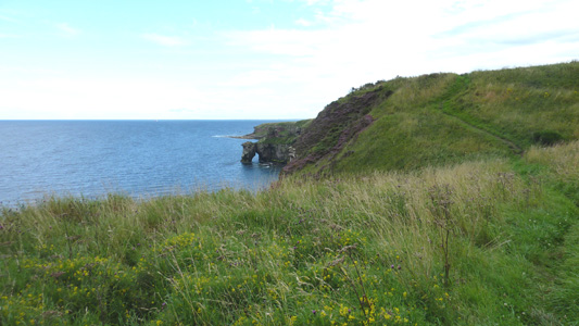
Crivens - a bit of a roller coaster - St Abbs Head in distance
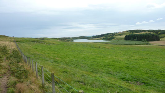
Coldingham Reservoir
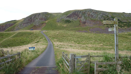
Joining the road into St Abbs. Straight on is St Abbs Head and the lighthouse. I took the easier option and turned right on the road here
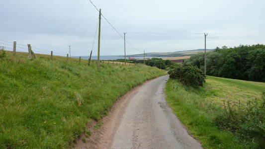
The easy road into St Abbs - Church in distance
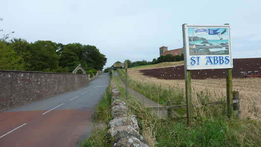
St Abbs - job done
